Mangroves in the Currimundi Catchment
Mangrove mapping in the catchment
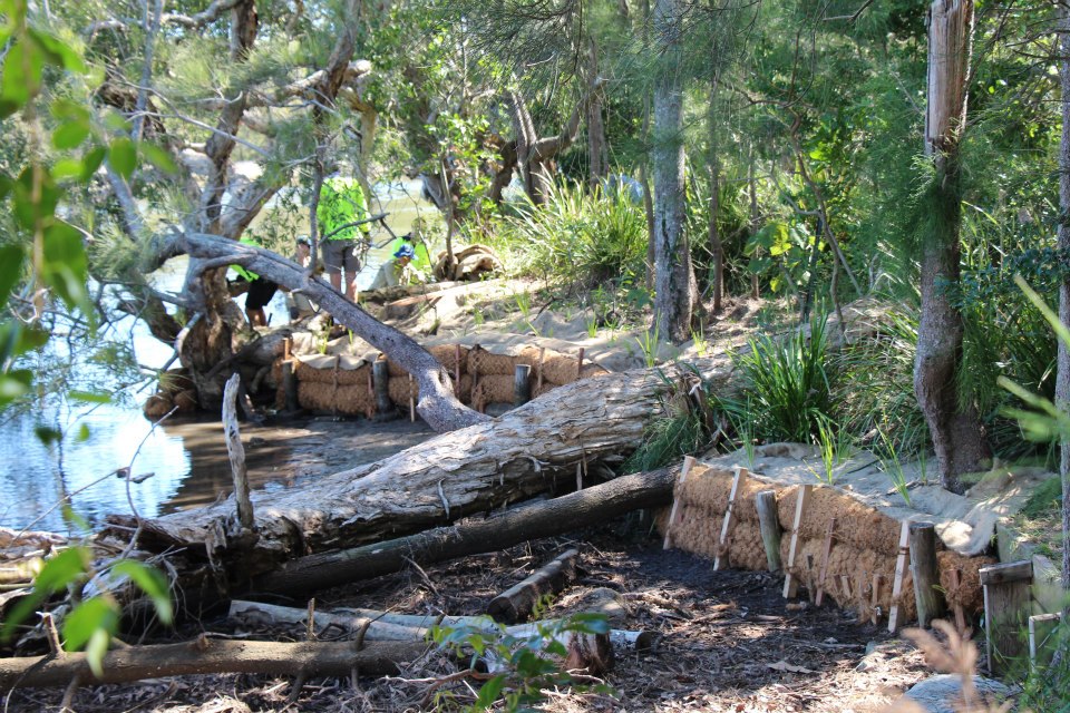
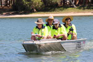
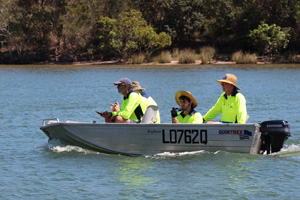
On Thursday 17 October 2013, four members of the Currimundi Catchment Care Group set out in a tinnie to map the locations of mangroves in Currimundi Lake and creeks. The primary aim of this project is to determine baseline data on the locations of mangroves, their physical characteristics and the diversity of species. Follow up studies will be undertaken to examine changes in the growth of mangroves, their distribution and mangrove health.
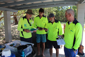
Two members of the group recently participated in a training program with MangroveWatch who developed the mangrove mapping methodology.
A video camera was used to film the entire shoreline of Currimundi lake and Currimundi Creek north and south arm, recording the presence of mangroves and other vegetation. GPS readings were taken at various points along the waterways and still photographs were taken of many physical features of the foreshore and waterways.
The initial video will be used as baseline data and follow up videos will be analysed by university researchers and students to track changes over time.

What is a mangrove?
A mangrove is a tree, shrub, palm or ground fern, generally exceeding one half metre in height, that normally grows above mean sea level in the intertidal zone of marine coastal environments and estuarine margins. A mangrove is also the tidal habitat comprising such trees and shrubs.
The word ‘mangrove’ refers to the habitat in the same way as we think of ‘rainforest’ with its mixture of plant types. Sometimes the habitat is called a ‘tidal forest’ or a ‘mangrove forest’ to distinguish it from the trees that are also called mangroves.
Mangrove plants are not a single genetic entity because the plant types represented in the tidal zone are not all closely related. So, while they sometimes look the same, and have similar function, this tells us more about the environment they live in, rather than their family relationships. There are 41 species of mangrove in Australia.
Why are mangroves important?
1. No mangroves – no fish!
Mangroves are essential habitat where bountiful and beneficial fish live, feed and breed. Mangroves nurture 75% of Queensland’s fish catch.
2. Healthy mangroves – healthy catchment!
Responsive mangroves act as end-of-catchment indicators. Mangroves show the effects of runoff sediments, nutrients and agricultural chemicals.
3. ‘Coastal kidneys’ – protect the Reef!
Coastal mangroves filter catchment runoff, and reduce shoreline erosion. Healthy mangroves support healthy marine environments with clearer, cleaner water – lower in sediments and chemicals.
(Acknowledgement: Mangrove Watch)
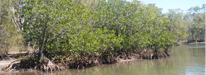
Which mangroves grow in the Currimundi catchment?
CCCG have identified two species, the red mangrove and grey mangrove (
Red mangrove (Rhizophora stylosa)
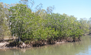
Red mangroves in North Queensland may grow to 20 m high, though trees of 4 to 5 m are more common elsewhere. The main trunk is erect and covered by rough, reddish-brown bark.
Stout, large arching prop roots are characteristic of the species, which support the main trunk and contain numerous lenticels (air pores) on their surfaces. The lenticels are air-filled spaces that connect with underground root structures. Aerial roots growing from the tree´s limbs also help the plant breathe. These do not take root even after reaching the soil and are produced by lower branches.
Leaves are oval-shaped, thick and leathery, and may reach 15 cm in length and 6 cm in width. They are dark green with numerous small, reddish-brown dots on the lower surface and a small deciduous pointed tip. Small, creamy-white flowers occur in branching pairs while the leaves are arranged in opposite pairs on the stem. (QLD Dept of Agriculture Forests & Fisheries)
Grey mangrove Avicennia marina (grey mangrove)
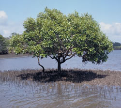
This mangrove is the most common and widespread mangrove found along the mainland coast of Australia.
Grey mangrove generally grows to 25 m high, though trees of 10 to 15 m are common in Queensland under favourable conditions. Trees have a large trunk covered by light grey, finely fissured bark that supports a spreading leafy crown.
Leaves measure up to 8 cm in length and 5 cm in width. They are oval, pointed and arranged opposite one another on the stems. The leaves are glossy green above with a distinctive pale and slightly hairy, grey underside. Stomata (pores) and salt glands are scattered over the entire leaf surface but are more abundant on the underside. Flowers are small and yellow, and appear in clusters.
A distinguishing feature of this species is the numerous spongy pencil-like pneumatophores (peg-like roots) that spread out from the base of the trunk. Pneumatophores originate from horizontal, underground lateral roots and grow vertically through the soil surface to enable the mangrove roots to breathe. (QLD Dept of Agriculture Forests & Fisheries)
Where can I find out more?
Mangrove Watch website. www.mangrovewatch.org.au
Department of Agriculture Forests and Fisheries (Queensland) – Common Mangroves.